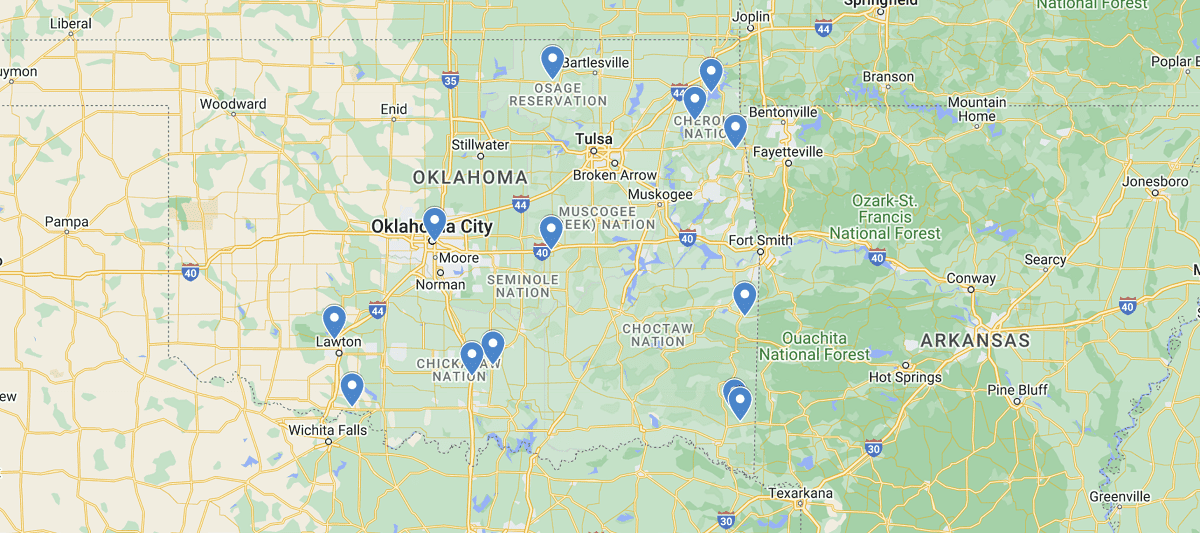
Oklahoma Waterfalls Map
As one of the lesser known states for waterfalls, Oklahoma surprisingly has quite a few spectacular cascading falls for you to enjoy. With it’s variety of hiking trails that range from a casual stroll in one of their state parks to trekking through the wilderness, there are secrete gems just waiting to be discovered. The best part is most of the waterfalls are within a quick driving distance from Oklahoma City making it easy to get out for a day of adventure.
In the map you’ll see that most falls are located in the central to eastern part of the state. Oklahoma City and Tulsa are two great starting points where you can set off for a day of outdoors before returning back for a good nights rest. Most of the falls do require some form of hiking to access them so we recommend carrying a compass and an actual map in case you lose reception and need to figure out where you are. Happy Exploring!
Listed out Waterfalls in Oklahoma Map
Antelope & Buffalo Springs, Sulphur
Beavers Bend Waterfall, McCurtain County
Bluestem Falls, Pawhuska
Bricktown Falls, Oklahoma City
Cache Creek, Wichita Mountains
Grand Lake O’ the Cherokees, Grand Lake
Heavener Runestone Falls, Le Flore
Little Niagara, Sulphur
Medicine Creek, Lawton
Natural Falls, West Siloam Springs
Post Oak Falls, Wichita Mountains
Presbyterian Falls, McCurtain County
Sand Creek Falls, Bartlesville
Spavinaw Area Spillway, Grand Lake
Turner Falls, Arbuckle Mountains
 Oregon Waterfalls Map