New York Waterfalls Map
From big city life to vast mountain ranges, New York is a unique state due to the abundance of attractions and urban life. Millions of people visit New York City every year, but rarely do you ever hear people talking about the amazing waterfalls that blanket the entire state. From massive 100 ft cascading waters to raging waters that seem to have a falls every few feet, New York is one of our favorite places to visit to enjoy a great hike and relaxing day at a swimming hole with the sound of a scenic waterfall in the background.
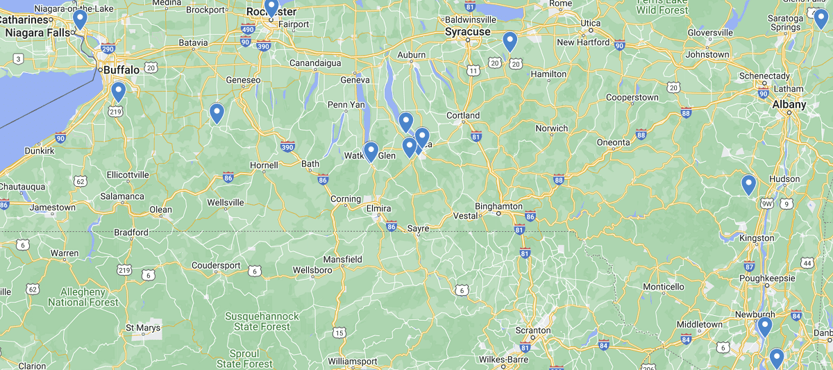
Central to Upstate New York is where you will find most waterfalls in the region. As you can see on the map there is a good condensed region around the Finger Lakes and then another bunching around Rochester and Buffalo. Use the interactive map to learn more about each falls and find the perfect spot for you. Many will require a bit of hiking, but it’s well worth it with the wildlife and scenery you will encounter. Happy Exploring!
Listed out Waterfalls in New York Map
Buttermilk Falls, Ithaca
Chittenango Falls, Madison County
Eternal Flame Falls, Orchard Park
Indian Brook Falls, Philipstown
Ithaca Falls, Ithaca
Kaaterskill Falls, Catskill Mountains
Lower Falls, Genesee River, Rochester
Lucifer Falls, Robert H Treman State Park, Ithaca
Middle Falls, Genesee River, Letchworth State Park
New Croton Dam, Westchester County
Niagara Falls, Buffalo
Rainbow Falls, Ausable Chasm, Adirondacks
Taughannock Falls, Ulysses
Upper Falls, Genesee River, Letchworth State Park
Watkins Glen Waterfalls, Seneca Lake
 Oklahoma Waterfalls Map