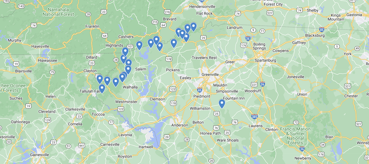
South Carolina Waterfalls Map
For those who want to capture the beauty of South Carolina’s majestic waterfalls, it’s luckily one state that seems to have all of them bunched together. With it’s mountain wilderness and cascading waters located on the borders of Georgia, Tennessee, and North Carolina, it’s the perfect destination from travelers in all four states to get out for a day or even weekend retreat and reconnect with mother nature.
Although we only listed 20 of the best waterfalls in SC on the map below, as you hike on the miles of paths in the north region you’ll discover so many more hidden gems. In fact there are at least 100 in the known area ranging in 50 foot drops to places you can jump into the swimming hole below as the water falls on top of you. When you are done taking in all the beauty, use the map to head back east and experience some of the best beaches in the United States. Happy Exploring!
Listed out Waterfalls in South Carolina Map
Brasstown Falls, Sumter National Forest, Oconee County
Falls Creek Falls, Mountain Bridge Wilderness Area
Issaqueena Falls, Sumter National Forest, Oconee County
King Creek Falls, Sumter National Forest, Onocee County
Laurel Fork Falls, Pickens County
Licklog Falls, Oconee County
Long Creek Falls, Onocee County
Lower Whitewater Falls, Oconee County
Opossum Creek Falls, Oconee County
Pigpen Falls, Oconee County
Rainbow Falls, Jones Gap State Park
Raven Cliff Falls, Mountain Bridge Wilderness Area
Spoonauger Falls, Sumter National Forest, Onocee County
Twin Falls, Pickens County
Yellow Branch Falls, Walhalla
 Texas Waterfalls Map