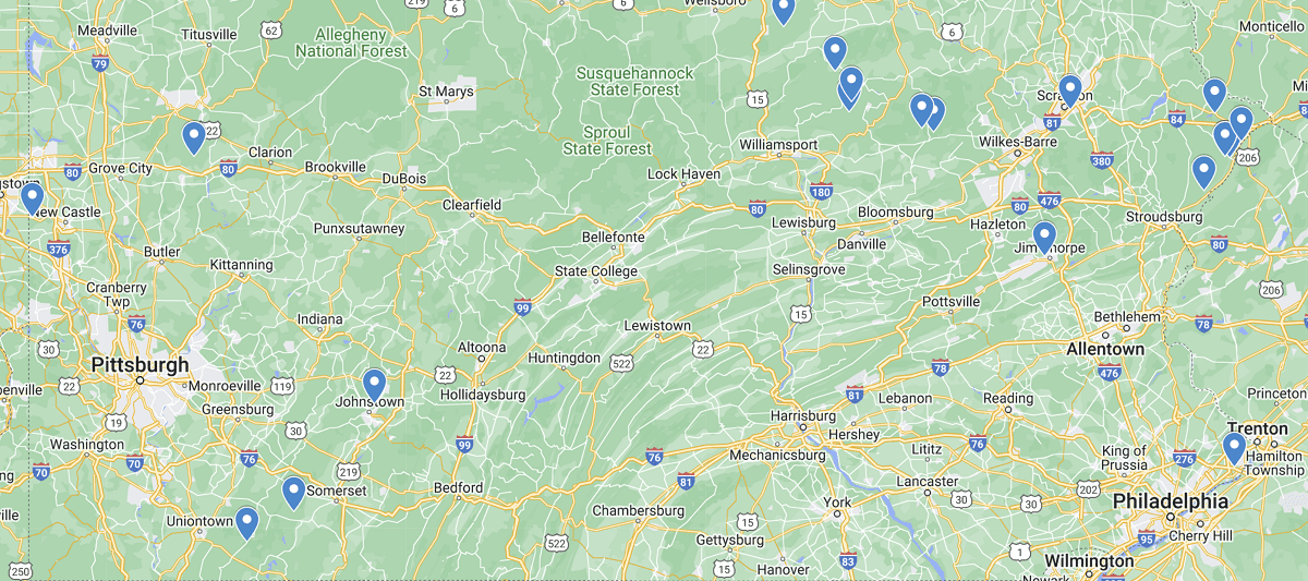
Pennsylvania Waterfalls Map
Boasting an impressive 85,000+ miles of rivers and streams, Pennsylvania is home to thousands of breathtaking waterfalls for you to explore. With some cascading down over 100 feet to others gently flowing over rocks through streams with just a few feet in elevation change, each one brings it’s own unique enjoyment and natural beauty to the great state of PA.
Although you can find a waterfall in almost any section of Pennsylvania, you’ll see on the map above that some of the more popular ones with scenic hikes and views tend to be in the north east or south west sections of the state. Most can be seen within a day of fun, but we highly recommend trying to make it a weekend getaway as most falls have quite a bit of other attractions around them. From epic hikes, camping under the stars, and even hidden hot springs along your journey, no map can truly show you all the things you can do when heading out into the great outdoors. Happy Exploring!
Listed out Waterfalls in Pennsylvania Map
Angel Falls
Bridal Veil Falls, Bushkill Falls, Pocono Mountains
Buttermilk Falls, Indiana County
Cole Run Falls
Cucumber Falls, Ohiopyle State Park
Deer Leap Falls, Childs Park
Dingmans Falls
Dry Run Falls, Loyalsock State Forest
Fall Brook Trail Waterfalls, Susquehanna County
Freedom Falls
Fulmer Falls, Childs Park
Ganoga Falls, Ricketts Glen State Park
Glen Onoko Falls, Jim Thorpe, Pocono Mountains
Hinkston Run Falls
Main Falls, Bushkill Falls, Pocono Mountains
Mill Creek Falls, York County
Nay Aug Falls, Scranton
Quakertown Falls, Lawrence County
Raymondskill Falls, Milford
Shohola Falls
Sullivan Falls
 South Carolina Waterfalls Map