North Carolina Waterfalls Map
The state of NC is home to over 50 waterfalls all throughout the state. Many can be found on hiking trails and are usually just an added bonus when enjoying the beautiful wilderness. Below we will break down each waterfall you can visit through the interactive map. Of course we highly recommend using your phone or an actual map when making the drive, but the pins will give you a rough idea of where you will be going and how far away each one is. Find one close to where you plan on staying and be sure to add it to your bucket list of places to visit. A few hours in the great outdoors with the serenity and peacefulness of a waterfall is a great way to rejuvenate your body and soul and remember what makes mother nature so great.
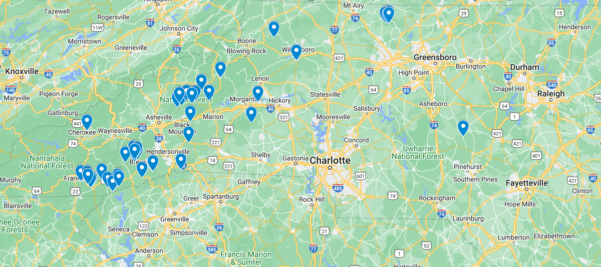
As you can see in the map most of the waterfalls are located on the western part of North Carolina. There are a couple located in parts of central and eastern NC, but Ashville is by far the best city to stay in to take advantage of visiting as many falls as possible. Luckily the majority of the waterfalls only require a short hike of under a mile once you have parked so if you do live a couple hours away, you can still plan a day trip and not have to worry about running out of time.
Listed out Waterfalls in NC Map
Betsey’s Rock Falls
Big Rock Falls (North Carolina)
Bridal Veil Falls (DuPont State Forest)
Bridal Veil Falls (Macon County)
Bull Cove Falls
Cascade Falls (Falls Creek)
Cascades Waterfall (Craggy Mountains)
Catawba Falls
Cedar Rock Falls
Connestee Falls and Batson Creek Falls
Corbin Creek Falls
Courthouse Falls
Crabtree Falls (North Carolina)
Cullasaja Falls
Douglas Falls
Drift Falls
Dry Falls (North Carolina)
Eastatoe Falls
Glassmine Falls
Hickory Nut Falls
Hidden Falls (Hanging Rock, North Carolina)
High Falls (DuPont State Forest)
High Shoals Falls
Hooker Falls
Key Falls
Linville Falls
Log Hollow Falls
Looking Glass Falls
Lower Cascades (Hanging Rock)
McGalliard Falls
Mingo Falls
Mitchell Falls
Moore Cove Falls
Moravian Falls
Pearson’s Falls
Quarry Falls (Macon County)
Rainbow Falls (Horsepasture River)
Rainbow Falls (Rutherford County)
Roaring Fork Falls (Yancey County)
Setrock Creek Falls
Silver Run Falls
Slick Rock Falls
Sliding Rock
Toms Creek Falls
Tory’s Falls (Hanging Rock)
Triple Falls (DuPont State Forest)
Turtleback Falls
Upper Cascades (Hanging Rock)
Upper Whitewater Falls
Walker Falls
Waterfall on West Prong Hickey Fork
Whiteoak Creek Falls
Window Falls (Hanging Rock)
Windy Falls
 Matilija Falls