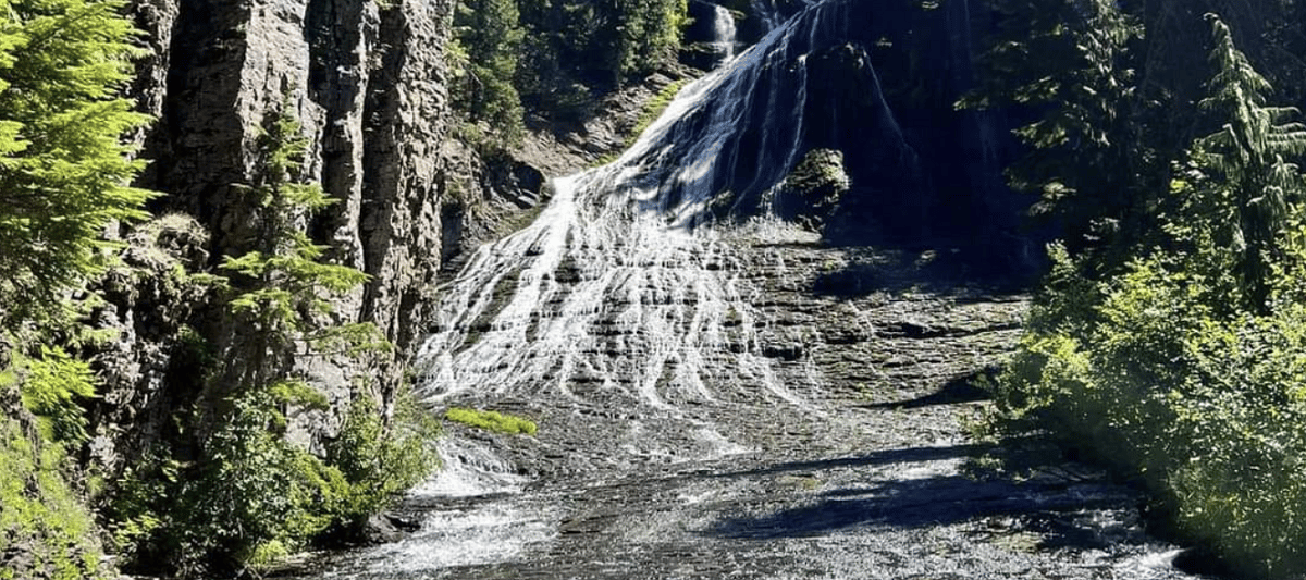
Walupt Creek Falls – Washington
For all the outdoor enthusiasts who enjoy a good challenge to reach an iconic destination such as a hot springs or waterfall out in the middle of nowhere, Walupt Creek Falls is right up your alley. 99% of the time directions to these remote locations involve you having to navigate easy to difficult trails that eventually reward you with captivating views. This is not the case when chasing this Washington Waterfall. However, once you make the journey and get up close to Walupt Falls, you’ll see why we consider this easily in the top 10 best waterfalls in the state.
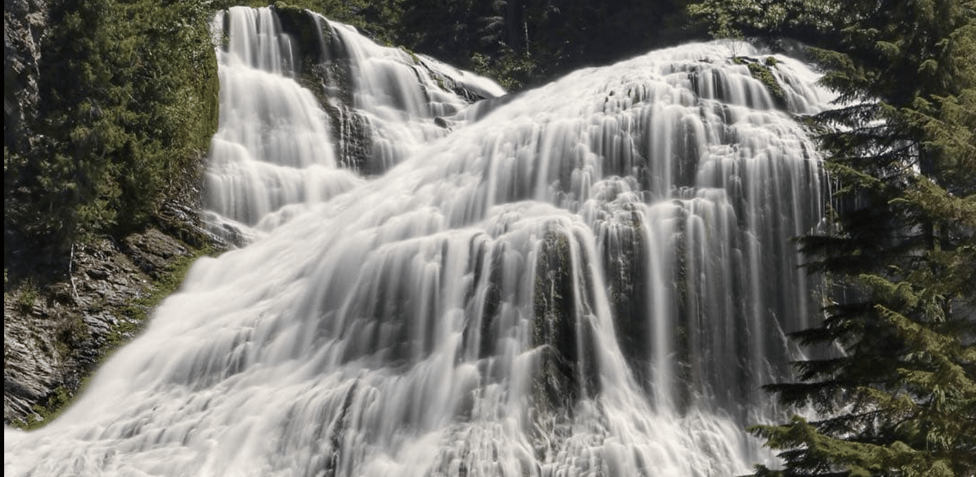
There are several tiers to Walupt Creek Falls with the cascading waters rushing down and dropping over 220 feet into the Cispus River. Between the trek to get here and the surrounding wilderness on all sides, it’s easily one of those places where you feel as if you have gone back in time and are the first person to stumble upon this iconic Washington natural wonder. Many locals say when you arrive, look for the large rock across the Cispus River as it will give you the best views of the waterfall.
Directions to Walupt Creek Falls
Driving to the parking area is the easy part in your quest to reach this hidden gem. Below use the maps for directions depending on which way you are coming from.
From Portland: Map
From Seattle: Map
Now that you have at least gotten to the starting point, it’s time to set your own path to this Oregon waterfall. Most of the trek will be through unmaintained lands and requires some creativity, logistics, and knowledge of using a physical map to continue in the right direction. Although it’s roughly a mile and half to get to the waterfall, be prepared to spend a couple hours bushwhacking and stopping to regroup to make sure you are still on course.
People in the past have left a few colored ribbons on trees to help lead the way so keep your head on a swivel. It’s ok if you don’t see any, but if you can try and follow that same line it seems to be the most popular path to follow.
There are a few things we highly recommend:
- It’s best to go in the summer to fall months to avoid any snow as that can completely derail any attempts at getting to the falls
- Make sure you have an experienced hiker with you as it can be somewhat easy to get lost or stuck in a challenging situation
- Know how to read a topographic map
- Give yourself 3-4 hours just for the journey to and from Walupt Creek Falls. It probably won’t take that long, but it’s always best to prepare for worst case scenarios.
Hopefully we didn’t scare you into avoiding this iconic waterfall. Although it’s definitely not the easiest place to visit, the reward at the end of the journey is how life long stories are created.
Hiking Trails around Walupt Creek Falls
Walupt Lake Trail: This 4.5-mile loop trail winds around Walupt Creek Falls and leads to a lake. It follows an old road grade that offers stunning views of the surrounding area, including the falls and Mount Rainier.
Goat Peak Trail: This 6-mile out-and-back hike is a great way to explore the area around Walupt Creek Falls. The trail begins near Mowich Lake Campground and climbs up 2,500 feet before reaching a viewpoint at Goat Peak with spectacular views of Mount Rainier and other nearby mountains.
Camping around Walupt Creek Falls
Walupt Lake Campground – This is the closest option near the falls and has dispersed tent camping all along the lake shore. Each site has it’s own firepits and tables.
Cougar Flats Campground – This campsite is rather small and offer 12 tent locations (8 standard and 4 walk-ins). There is a nearby lake often used for boating and fishing.
 Sacred Falls