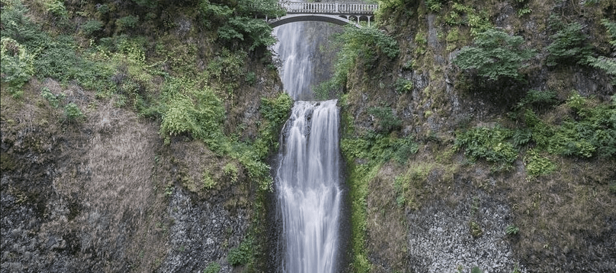
Multnomah Falls is a magnificent two-tiered waterfall located in the Columbia River Gorge, on the Oregon side of the border between Washington and Oregon. The falls drop a total of 620 feet (189 meters) in two major steps, making it one of the highest waterfalls in North America.

Multnomah Falls has been an important landmark for visitors to the Pacific Northwest since its discovery by Lewis and Clark during their expedition in 1805. The lower tier of Multnomah Falls drops 542 feet (165 m), while the upper tier drops an additional 69 feet (21 m). At its base, there are several viewing platforms that allow visitors to get close to this powerful natural wonder. The roar of falling
water can be heard from miles away and draws many people each year who want to witness nature’s beauty firsthand. In addition to being a beautiful sight, Multnomah Falls also serves as an important source of hydropower for Portland residents.
Atop Multnomah Falls stands Benson Bridge, built in 1914 with funding from Simon Benson as part of his plan to make all areas around his properties accessible via trails or roads so that everyone could experience them first-hand. This bridge provides spectacular views upriver toward Mt Hood and downriver towards Cascade Locks. It also provides access across both tiers for hikers wishing to continue further along either trail system connected at each end – eastward along Oneonta Trail or westward along Larch Mountain Trailhead which gains elevation quickly into view overlooking Crown Point Vista House and other viewpoints further downstream near Corbett Hill Road exit off I84 freeway corridor leading back towards Portland city limits area below.
For those wanting even more incredible views than what can be found atop Benson Bridge itself; they should look no further than nearby Angel’s Rest viewpoint just 1 mile upriver from here where one can have panoramic vistas spanning outwards over entire river gorge looking eastward towards Beacon Rock State Park & Bonneville Dam then northwards across vast expanse sky filled with clouds rising above majestic Mount St Helens volcano peak far off horizon line.
Today Multnomah County continues efforts through various ongoing projects such as restoring native fish populations within streambeds surrounding falls area as well maintaining trails which provide access throughout region including popular Wahkeena Loop Trail winding its way upstream before cascading downhill alongside roadway leading back down towards main parking lot entrance once again. With these improvements made available public now able enjoy splendor beauty this great natural wonder full potential!
 Biggest Cities in Alabama